
Caribbean · Territory


Anguilla: Travel Guide & Requirements
Anguilla is a territory in Caribbean with its capital in The Valley. It covers 91 km². The official language is English. The currency is the Eastern Caribbean dollar (XCD, $).
Where is Anguilla? Map of Anguilla
Caribbean, islands between the Caribbean Sea and North Atlantic Ocean, east of Puerto Rico.
- Region
- Caribbean
- Coordinates
- 18.25° N, 63.1667° W
- Neighbours
- none (no land borders)
- Coastline
- 61 km
- Anguilla
- Capital
Travel requirements
What you need to travel to Anguilla
- Passport
A passport valid for your whole stay (check the rules of the governing country).
- Travel advice
Safe to visit — US and UK advice.
Before you go
10 things to know before you travel to Anguilla
- Safety: Yes — Anguilla is generally safe to visit: the US State Department rates Anguilla Level 1 (“Exercise Normal Precautions”), and the UK Foreign Office has no warnings against travel there.
- Best time to go: December to April — when daytime highs in The Valley are around 26–27°C.
- Money: the Eastern Caribbean dollar (XCD) — 1 US dollar is about 2.7070 XCD.
- Plugs: type A and B, 110 V / 120 V / 127 V / 240 V, 60 Hz — mixed voltage: check the socket before you plug in. Dual-voltage chargers (100–240 V) work everywhere.
- Emergency numbers: Police 911, Ambulance 911, Fire 911.
- Language: English is official.
- Driving: on the left.
- Time zone: UTC-4 in The Valley.
- Capital: The Valley.
- Outdoors: 1 national park.
Key facts
Anguilla at a glance
Languages spoken: English (official)
Geography & history
About Anguilla
English settlers from Saint Kitts first colonized Anguilla in 1650. Great Britain administered the island until the early 19th century, when -- against the wishes of the inhabitants -- Anguilla was incorporated into a single British dependency along with Saint Kitts and Nevis. Several attempts at separation failed. In 1971, two years after a revolt, Anguilla was finally allowed to secede; this arrangement was formally recognized in 1980, when Anguilla became a separate British dependency. In 2017, Hurricane Irma caused extensive damage on the island, particularly to communications and residential and business infrastructure.
Location
Caribbean, islands between the Caribbean Sea and North Atlantic Ocean, east of Puerto Rico
Climate
tropical; moderated by northeast trade winds
Terrain
flat and low-lying island of coral and limestone
Highest point
Crocus Hill 73 m
Natural resources
salt, fish, lobster
Natural hazards
frequent hurricanes and other tropical storms (July to October)
National symbols
dolphin
Safety
Is Anguilla safe to visit?
Yes — Anguilla is generally safe to visit: the US State Department rates Anguilla Level 1 (“Exercise Normal Precautions”), and the UK Foreign Office has no warnings against travel there.
 US State Department
 UK Foreign Office (FCDO)
Latest update: Updated information about crime ('Safety and security' page).
Updated 15 May 2025 · Full travel advice
Sources: US Department of State travel advisories (public domain) and UK FCDO foreign travel advice (contains public sector information licensed under the Open Government Licence v3.0). Checked daily. Advice can change quickly — always read the official page before you travel.
Weather
Best time to visit Anguilla
The best time to visit Anguilla is December to April, when daytime highs in The Valley are around 26–27°C. May to July and November are also a good time to go. September is the warmest month (29°C by day), February the coldest (25°C at night), and October the wettest with about 108 mm of rain.
- Jan26°C25°C
- Feb26°C25°C
- Mar26°C25°C
- Apr27°C26°C
- May28°C27°C
- Jun28°C27°C
- Jul29°C28°C
- Aug29°C28°C
- Sep29°C28°C
- Oct29°C28°C
- Nov28°C27°C
- Dec27°C26°C
Best time Good Less ideal
Before you go
Plugs, voltage & emergency numbers in Anguilla
Plugs & sockets
110 V / 120 V / 127 V / 240 V, 60 Hz · Mixed voltage: check the socket before you plug in. Dual-voltage chargers (100–240 V) work everywhere.
Emergency numbers
Save the local numbers before you travel — 112 or 911 may not connect here. All countries →
Sources: Wikipedia — Mains electricity by country and List of emergency telephone numbers (CC BY-SA 4.0).
National parks
1 national park in Anguilla
Largest: Fountain Cavern National Park
Currency · 26 October 2026
Eastern Caribbean dollar exchange rates today
Anguilla uses the Eastern Caribbean dollar (XCD, $). One US dollar buys 2.7070 XCD; over the last 30 days the XCD has lost 0.2% against the dollar.
What other currencies cost in XCD
Currency converter
Daily reference rates from the open-source currency-api (CC0), 26 Oct 2026. Banks and exchange offices add a margin.
World rankings
Where Anguilla ranks
How Anguilla compares with the rest of the world — open any card for the full ranking.
Airports
Airports in Anguilla
1 airports and airfields — 0 large, 1 medium and 0 small, plus 0 heliports. 1 have scheduled passenger flights.
Borders
No land borders
Anguilla has no land borders with other countries. Coastline: 61 km.
People
Population & society
Religion
Largest cities: The Valley (1,000)
Economy
Economy
Main industries
tourism, boat building, offshore financial services
Export partners
Chile 60%, Netherlands 8%, Brazil 5%, Hungary 4%, USA 4% (2023)
Top exports
packaged medicine, garments, vehicle parts/accessories, vaccines, cars (2023)
News
Latest travel news about Anguilla
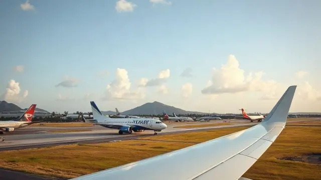
New Office for Trans Anguilla Airways Opens in St. Kitts
Trans Anguilla Airways has opened a new office at Robert L. Bradshaw International Airport, enhancing regional air connectivity vital for tourism and…

BermudAir Adds Nonstop Flights to Belize From 5 U.S. Cities This Winter
BermudAir is launching seasonal nonstop flights to Belize City from Boston, Raleigh-Durham and three Florida airports, with services running from lat…
Frequently asked questions about Anguilla
What do I need to travel to Anguilla?
Where is Anguilla?
What is Anguilla known for?
What is the capital of Anguilla?
What language is spoken in Anguilla?
What currency does Anguilla use?
What is the calling code of Anguilla?
Does Anguilla have land borders?
Is Anguilla safe to visit?
When is the best time to visit Anguilla?
What plug type does Anguilla use?
How many airports does Anguilla have?
Sources: CIA World Factbook (public domain); World Bank Open Data (CC BY 4.0); names, languages and currencies: mledoze/countries (ODbL); flag: flag-icons (MIT); coat of arms: Wikimedia Commons (file page); exchange rates: Daily reference rates from the open-source currency-api (CC0); airports: OurAirports.