
Eastern Africa · Territory

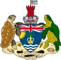
British Indian Ocean Territory: Travel Guide & Requirements
The British Indian Ocean Territory is a territory in Eastern Africa with its capital in administered from London. It covers 60 km². The official language is English. The currency is the United States dollar (USD, $).
Where is the British Indian Ocean Territory? Map of the British Indian Ocean Territory
archipelago in the Indian Ocean, south of India, about halfway between Africa and Indonesia.
- Region
- Eastern Africa
- Coordinates
- 6° S, 71.5° E
- Neighbours
- none (no land borders)
- Coastline
- 698 km
- British Indian Ocean Territory
- Capital
Travel requirements
What you need to travel to the British Indian Ocean Territory
- Passport
A passport valid for your whole stay (check the rules of the governing country).
- Travel advice
Safe to visit — US and UK advice.
Before you go
8 things to know before you travel to the British Indian Ocean Territory
- Safety: Yes — the British Indian Ocean Territory is generally safe to visit: the UK Foreign Office has no warnings against travel there.
- Best time to go: May to October — when daytime highs in administered from London are around 22–26°C.
- Money: the United States dollar (USD) — 1 euro is about 1.1222 USD.
- Emergency numbers: Police 112 / 999, Ambulance 112 / 999, Fire 112 / 999.
- Language: English is official.
- Driving: on the right.
- Time zone: UTC+6 in administered from London.
- Capital: administered from London.
Key facts
British Indian Ocean Territory at a glance
Geography & history
About the British Indian Ocean Territory
Formerly administered as part of the British Crown Colony of Mauritius, the British Indian Ocean Territory (BIOT) was established as an overseas territory of the UK in 1965. A number of the islands in the territory were later transferred to the Seychelles when it gained independence in 1976. Subsequently, BIOT has consisted of the six main island groups that make up the Chagos Archipelago. Only Diego Garcia, the largest and most southerly of the islands, is inhabited. It contains a joint UK-US naval support facility and hosts one of four dedicated ground antennas that assist in the operation of the Global Positioning System (GPS) navigation system -- the others are on Kwajalein (Marshall Is…
Read the full history
Formerly administered as part of the British Crown Colony of Mauritius, the British Indian Ocean Territory (BIOT) was established as an overseas territory of the UK in 1965. A number of the islands in the territory were later transferred to the Seychelles when it gained independence in 1976. Subsequently, BIOT has consisted of the six main island groups that make up the Chagos Archipelago. Only Diego Garcia, the largest and most southerly of the islands, is inhabited. It contains a joint UK-US naval support facility and hosts one of four dedicated ground antennas that assist in the operation of the Global Positioning System (GPS) navigation system -- the others are on Kwajalein (Marshall Islands); at Cape Canaveral, Florida (US); and on Ascension Island (Saint Helena, Ascension, and Tristan da Cunha). The US Air Force also operates a telescope array on Diego Garcia as part of the Ground-Based Electro-Optical Deep Space Surveillance System (GEODSS) for tracking orbital debris, which can be a hazard to spacecraft and astronauts. Between 1967 and 1973, the former agricultural workers who lived on the islands were relocated, primarily to Mauritius but also to the Seychelles. Negotiations with the UK between 1971 and 1982 resulted in the establishment of a trust fund to compensate the displaced islanders, known as Chagossians. Beginning in 1998, the islanders pursued a series of lawsuits against the British Government, seeking further compensation and the right to return to the territory. British court rulings in 2006 and 2007 invalidated immigration policies that had excluded the islanders from the archipelago, but in 2008, the House of Lords -- the final court of appeal in the UK -- ruled in favor of the British Government by overturning the lower court rulings and finding no right of return for the Chagossians. In 2015, the Permanent Court of Arbitration unanimously held that the marine protected area that the UK declared around the Chagos Archipelago in 2010 violated the UN Convention on the Law of the Sea. In 2019, the International Court of Justice ruled in an advisory opinion that Britain’s decolonization of Mauritius was not lawful because of continued Chagossian claims. A non-binding 2019 UN General Assembly vote demanded that Britain end its “colonial administration” of the Chagos Archipelago and that it be returned to Mauritius. On 22 May 2025, the United Kingdom and Mauritius signed an agreement that will lead to the transfer of sovereignty of the Chagos Archipelago to Mauritius. Under the agreement, the United Kingdom will lease Diego Garcia from Mauritius for 99 years and maintain full operational control of the joint UK-US military base.
Location
archipelago in the Indian Ocean, south of India, about halfway between Africa and Indonesia
Climate
tropical marine; hot, humid, moderated by trade winds
Terrain
flat and low coral atolls (most areas do not exceed 2 m, or 6.6 ft, in elevation); sits atop the submarine volcanic Chagos-Laccadive Ridge
Highest point
ocean-side dunes on Diego Garcia 9 m
Natural resources
coconuts, fish, sugarcane
Natural hazards
none; located outside routes of Indian Ocean cyclones
Safety
Is the British Indian Ocean Territory safe to visit?
Yes — the British Indian Ocean Territory is generally safe to visit: the UK Foreign Office has no warnings against travel there.
 UK Foreign Office (FCDO)
Latest update: This travel advice has been rewritten to make it easier to read and understand.
Updated 8 Apr 2024 · Full travel advice
Sources: US Department of State travel advisories (public domain) and UK FCDO foreign travel advice (contains public sector information licensed under the Open Government Licence v3.0). Checked daily. Advice can change quickly — always read the official page before you travel.
Weather
Best time to visit the British Indian Ocean Territory
The best time to visit the British Indian Ocean Territory is May to October, when daytime highs in administered from London are around 22–26°C. November to February are also a good time to go. March is the warmest month (28°C by day), August the coldest (21°C at night), and March the wettest with about 101 mm of rain.
- Jan27°C27°C
- Feb28°C27°C
- Mar28°C28°C
- Apr28°C27°C
- May26°C26°C
- Jun24°C23°C
- Jul22°C21°C
- Aug22°C21°C
- Sep23°C22°C
- Oct25°C24°C
- Nov27°C26°C
- Dec27°C26°C
Best time Good Less ideal
Before you go
Plugs, voltage & emergency numbers in the British Indian Ocean Territory
Sources: Wikipedia — Mains electricity by country and List of emergency telephone numbers (CC BY-SA 4.0).
Currency · 26 October 2026
United States dollar exchange rates today
The British Indian Ocean Territory uses the United States dollar (USD, $).
What other currencies cost in USD
Currency converter
Daily reference rates from the open-source currency-api (CC0), 26 Oct 2026. Banks and exchange offices add a margin.
World rankings
Where the British Indian Ocean Territory ranks
How the British Indian Ocean Territory compares with the rest of the world — open any card for the full ranking.
Airports
Airports in the British Indian Ocean Territory
1 airports and airfields — 0 large, 1 medium and 0 small, plus 0 heliports. 0 have scheduled passenger flights.
Borders
No land borders
The British Indian Ocean Territory has no land borders with other countries. Coastline: 698 km.
People
Population & society
Economy
Economy
Export partners
Singapore 86%, Pakistan 8%, USA 1%, South Africa 1%, Czechia 1% (2023)
Top exports
fish (2023)
Travel tools
Handy before every trip to the British Indian Ocean Territory
Frequently asked questions about the British Indian Ocean Territory
What do I need to travel to the British Indian Ocean Territory?
Where is the British Indian Ocean Territory?
What is the capital of the British Indian Ocean Territory?
What language is spoken in the British Indian Ocean Territory?
What currency does the British Indian Ocean Territory use?
What is the calling code of the British Indian Ocean Territory?
Does the British Indian Ocean Territory have land borders?
Is the British Indian Ocean Territory safe to visit?
When is the best time to visit the British Indian Ocean Territory?
How many airports does the British Indian Ocean Territory have?
Sources: CIA World Factbook (public domain); World Bank Open Data (CC BY 4.0); names, languages and currencies: mledoze/countries (ODbL); flag: flag-icons (MIT); coat of arms: Wikimedia Commons (file page); exchange rates: Daily reference rates from the open-source currency-api (CC0); airports: OurAirports.