
Polynesia · Territory

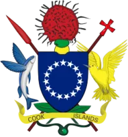
Cook Islands: Travel Guide & Requirements
· Kūki 'Āirani
The Cook Islands is a territory in Polynesia with its capital in Avarua. It covers 236 km². The official languages are English and Cook Islands Māori. The currency is the Cook Islands dollar (CKD, $).
Where is the Cook Islands? Map of the Cook Islands
Oceania, group of islands in the South Pacific Ocean, about halfway between Hawaii and New Zealand.
- Region
- Polynesia
- Coordinates
- 21.2333° S, 159.7667° W
- Neighbours
- none (no land borders)
- Coastline
- 120 km
- Cook Islands
- Capital
Before you go
8 things to know before you travel to the Cook Islands
- Best time to go: June to October — when daytime highs in Avarua are around 24–25°C.
- Money: the Cook Islands dollar (CKD).
- Plugs: type I, 240 V, 50 Hz — standard 220–240 V: devices from the US or Japan (110–120 V) need a converter unless they are dual voltage (100–240 V).
- Emergency numbers: Police 999, Ambulance 999, Fire 999.
- Language: English and Cook Islands Māori are official.
- Driving: on the left — speed limits are 50 km/h in built-up areas and 50 km/h outside built-up areas.
- Time zone: UTC-10 in Avarua.
- Capital: Avarua.
Key facts
Cook Islands at a glance
Languages spoken: English (official) 86.4%, Cook Islands Maori (Rarotongan) (official) 76.2%, other 8.3% (2011 est.)
Geography & history
About the Cook Islands
Polynesians from Tahiti were probably the first people to settle Rarotonga -- the largest of the Cook Islands -- around A.D. 900. Over time, Samoans and Tongans also settled in Rarotonga, and Rarotongans voyaged to the northern Cook Islands, settling Manihiki and Rakahanga. Pukapuka and Penrhyn in the northern Cook Islands were settled directly from Samoa. Prior to European contact, there was considerable travel and trade between inhabitants of the different islands and atolls, but they were not united in a single political entity. Spanish navigators were the first Europeans to spot the northern Cook Islands in 1595, followed by the first landing in 1606, but no further European contact occ…
Read the full history
Polynesians from Tahiti were probably the first people to settle Rarotonga -- the largest of the Cook Islands -- around A.D. 900. Over time, Samoans and Tongans also settled in Rarotonga, and Rarotongans voyaged to the northern Cook Islands, settling Manihiki and Rakahanga. Pukapuka and Penrhyn in the northern Cook Islands were settled directly from Samoa. Prior to European contact, there was considerable travel and trade between inhabitants of the different islands and atolls, but they were not united in a single political entity. Spanish navigators were the first Europeans to spot the northern Cook Islands in 1595, followed by the first landing in 1606, but no further European contact occurred until the 1760s. In 1773, British explorer James COOK spotted Manuae in the southern Cook Islands, and Russian mapmakers named the islands after COOK in the 1820s. Fearing France would militarily occupy the islands as it did in Tahiti, Rarotongans asked the UK for protectorate status in the 1840s and 1860s, a request the UK ignored. In 1888, Queen MAKEA TAKAU of Rarotonga formally petitioned for protectorate status, to which the UK reluctantly agreed. In 1901, the UK placed Rarotonga and the rest of the islands in the New Zealand Colony, and in 1915, the Cook Islands Act organized the islands into one political entity. It remained a protectorate until 1965, when New Zealand granted the Cook Islands self-governing status. The Cook Islands has a great deal of local autonomy and is an independent member of international organizations, but it is in free association with New Zealand, which is responsible for its defense and foreign affairs. In September 2023, the US recognized the Cook Islands as a sovereign and independent state.
Location
Oceania, group of islands in the South Pacific Ocean, about halfway between Hawaii and New Zealand
Climate
tropical oceanic; moderated by trade winds; a dry season from April to November and a more humid season from December to March
Terrain
low coral atolls in north; volcanic, hilly islands in south
Highest point
Te Manga 652 m
Natural resources
coconuts (copra)
Natural hazards
tropical cyclones (November to March)
National symbols
a circle of 15 five-pointed white stars on a blue field, tiare maori flower (Gardenia taitensis)
Driving
Speed limits & road rules in the Cook Islands
The default speed limits in the Cook Islands are 50 km/h in built-up areas and 50 km/h outside built-up areas. The legal alcohol limit for drivers is 0.8‰. Posted signs always take priority over these defaults.
- 5050 km/hBuilt-up areasTowns and citiesWHO data (2017)
- 5050 km/hOutside built-up areasCountry roadsWHO data (2017)
- International Driving PermitNot a party to the IDP conventionsCheck with the embassy whether your licence is accepted
- Driving sideDrive on the leftOvertake on the right
- Alcohol limit0.8‰ blood alcohol (0.08% BAC)
- Seat beltsNo national seat-belt law
- Child seatsNo national child-restraint law
- Motorcycle helmetsRequired for riders
- Road deaths (2021)17.6 per 100,000 peopleHigher than most countries (median 12.4)
Speed limits: OpenStreetMap wiki — Default speed limits (CC BY-SA 2.0) and WHO. Road-safety laws: WHO Global Health Observatory. Compare speed limits and alcohol limits by country. Defaults for cars; local signs, weather and vehicle type can lower them.
Weather
Best time to visit the Cook Islands
The best time to visit the Cook Islands is June to October, when daytime highs in Avarua are around 24–25°C. April to May and November to December are also a good time to go. March is the warmest month (27°C by day), August the coldest (23°C at night), and February the wettest with about 202 mm of rain.
- Jan27°C26°C
- Feb27°C26°C
- Mar27°C27°C
- Apr27°C26°C
- May26°C25°C
- Jun25°C24°C
- Jul24°C23°C
- Aug24°C23°C
- Sep24°C23°C
- Oct24°C24°C
- Nov25°C24°C
- Dec26°C25°C
Best time Good Less ideal
Before you go
Plugs, voltage & emergency numbers in the Cook Islands
Plugs & sockets
240 V, 50 Hz · Standard 220–240 V: devices from the US or Japan (110–120 V) need a converter unless they are dual voltage (100–240 V).
Emergency numbers
Save the local numbers before you travel — 112 or 911 may not connect here. All countries →
Sources: Wikipedia — Mains electricity by country and List of emergency telephone numbers (CC BY-SA 4.0).
World rankings
Where the Cook Islands ranks
How the Cook Islands compares with the rest of the world — open any card for the full ranking.
Airports
Airports in the Cook Islands
10 airports and airfields — 1 large, 0 medium and 9 small, plus 0 heliports. 6 have scheduled passenger flights.
Borders
No land borders
The Cook Islands has no land borders with other countries. Coastline: 120 km.
People
Population & society
Religion
Economy
Economy
Main industries
fishing, fruit processing, tourism, clothing, handicrafts
Export partners
Japan 33%, Thailand 15%, Greece 15%, France 11%, China 8% (2023)
Top exports
fish, ships, garments, shellfish (2023)
Travel tools
Handy before every trip to the Cook Islands
News
Latest travel news about the Cook Islands
Stranded in Cook Islands: Transit Visa Issues Persist for Foreign National
A foreign national has been stranded in the Cook Islands for three years due to unresolved transit visa approvals from New Zealand and Australia, des…
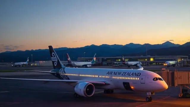
Travellers Gain Six More Nonstop NZ Flights in 2026, Christchurch Long-Haul Returns
Air New Zealand is launching six nonstop routes in 2026, including the first international flights to Western Sydney Airport and the return of long-h…
Frequently asked questions about the Cook Islands
Where is the Cook Islands?
What is the capital of the Cook Islands?
What language is spoken in the Cook Islands?
What currency does the Cook Islands use?
What is the calling code of the Cook Islands?
Does the Cook Islands have land borders?
What is the speed limit in the Cook Islands?
When is the best time to visit the Cook Islands?
What plug type does the Cook Islands use?
How many airports does the Cook Islands have?
Sources: CIA World Factbook (public domain); World Bank Open Data (CC BY 4.0); names, languages and currencies: mledoze/countries (ODbL); flag: flag-icons (MIT); coat of arms: Wikimedia Commons (file page); exchange rates: Daily reference rates from the open-source currency-api (CC0); airports: OurAirports.