
Caribbean · Territory

Curacao: Travel Guide & Requirements
Country of Curaçao · Country of Curaçao · Land Curaçao
Curacao is a territory in Caribbean with its capital in Willemstad. It has a population of 156,263 (#185 in the world) and covers 444 km². The official languages are English, Dutch and Papiamento. The currency is the Netherlands Antillean guilder (ANG, ƒ).
Where is Curacao? Map of Curacao
Caribbean, an island in the Caribbean Sea, 55 km off the coast of Venezuela.
- Region
- Caribbean
- Coordinates
- 12.1167° N, 68.9333° W
- Neighbours
- none (no land borders)
- Coastline
- 364 km
- Curacao
- Capital
Travel requirements
What you need to travel to Curacao
- Passport
A passport valid for your whole stay (check the rules of the governing country).
- Travel advice
Safe to visit — US and UK advice.
Before you go
10 things to know before you travel to Curacao
- Safety: Yes — Curacao is generally safe to visit: the US State Department rates Curacao Level 1 (“Exercise Normal Precautions”), and the UK Foreign Office has no warnings against travel there.
- Best time to go: January to July — when daytime highs in Willemstad are around 27–28°C.
- Money: the Netherlands Antillean guilder (ANG) — 1 US dollar is about 1.7995 ANG.
- Plugs: type A, B and F, 127 V, 50 Hz — low-voltage country: devices made only for 220–240 V need a voltage converter. Phone and laptop chargers (100–240 V) only need a plug adapter.
- Emergency numbers: Police 911, Ambulance 910 / 912, Fire 911.
- Language: English, Dutch and Papiamento are official.
- Driving: on the right — speed limits are 40 km/h in built-up areas, 60 km/h outside built-up areas and 80 km/h on expressways.
- Time zone: UTC-4 in Willemstad.
- Capital: Willemstad. About 156,263 people live in Curacao.
- Outdoors: 2 national parks.
Key facts
Curacao at a glance
Languages spoken: Papiamento (official) (a creole language that is a mixture of Portuguese, Spanish, Dutch, English, and, to a lesser extent, French, as well as elements of African languages and the language of the Arawak) 80%, Dutch (official) 8.8%, Spanish 5.6%, English (official) 3.1%, other 2.3%, unspecified 0.3% (2011 est.)
Geography & history
About Curacao
The original Arawak Indian settlers who arrived on Curaçao from South America in about A.D. 1000 were largely enslaved by the Spanish early in the 16th century and forcibly relocated to other colonies where labor was needed. The Dutch seized Curaçao from the Spanish in 1634. Once the center of the Caribbean slave trade, Curaçao was hard hit economically when the Dutch abolished slavery in 1863. Its prosperity (and that of neighboring Aruba) was restored in the early 20th century with the construction of the Isla Refineria to service the newly discovered Venezuelan oilfields. In 1954, Curaçao and several other Dutch Caribbean colonies were reorganized as the Netherlands Antilles, part of the…
Read the full history
The original Arawak Indian settlers who arrived on Curaçao from South America in about A.D. 1000 were largely enslaved by the Spanish early in the 16th century and forcibly relocated to other colonies where labor was needed. The Dutch seized Curaçao from the Spanish in 1634. Once the center of the Caribbean slave trade, Curaçao was hard hit economically when the Dutch abolished slavery in 1863. Its prosperity (and that of neighboring Aruba) was restored in the early 20th century with the construction of the Isla Refineria to service the newly discovered Venezuelan oilfields. In 1954, Curaçao and several other Dutch Caribbean colonies were reorganized as the Netherlands Antilles, part of the Kingdom of the Netherlands. In referenda in 2005 and 2009, the citizens of Curaçao voted to become a self-governing country within the Kingdom of the Netherlands. The change in status became effective in 2010 with the dissolution of the Netherlands Antilles.
Location
Caribbean, an island in the Caribbean Sea, 55 km off the coast of Venezuela
Climate
tropical marine climate, ameliorated by northeast trade winds, results in mild temperatures; semiarid with average rainfall of 60 cm/year
Terrain
generally low, hilly terrain
Highest point
Mt. Christoffel 372 m
Natural resources
calcium phosphates, protected harbors, hot springs
Natural hazards
Curacao is south of the Caribbean hurricane belt and is rarely threatened
National symbols
laraha (citrus tree)
Driving
Speed limits & road rules in Curacao
The default speed limits in Curacao are 40 km/h in built-up areas, 60 km/h outside built-up areas and 80 km/h on expressways. Posted signs always take priority over these defaults.
- 4040 km/hBuilt-up areasTowns and cities
- 6060 km/hOutside built-up areasCountry roads
- 8080 km/hExpresswaysDual carriageways & expressways
- International Driving PermitNot a party to the IDP conventionsCheck with the embassy whether your licence is accepted
- Driving sideDrive on the rightOvertake on the left
Speed limits: OpenStreetMap wiki — Default speed limits (CC BY-SA 2.0). Road-safety laws: WHO Global Health Observatory. Compare speed limits and alcohol limits by country. Defaults for cars; local signs, weather and vehicle type can lower them.
Safety
Is Curacao safe to visit?
Yes — Curacao is generally safe to visit: the US State Department rates Curacao Level 1 (“Exercise Normal Precautions”), and the UK Foreign Office has no warnings against travel there.
 US State Department
 UK Foreign Office (FCDO)
Latest update: New information about dual nationals returning to the UK (‘Entry requirements’ page).
Updated 10 Dec 2025 · Full travel advice
Sources: US Department of State travel advisories (public domain) and UK FCDO foreign travel advice (contains public sector information licensed under the Open Government Licence v3.0). Checked daily. Advice can change quickly — always read the official page before you travel.
Weather
Best time to visit Curacao
The best time to visit Curacao is January to July, when daytime highs in Willemstad are around 27–28°C. August to October and December are also a good time to go. September is the warmest month (29°C by day), February the coldest (26°C at night), and November the wettest with about 117 mm of rain.
- Jan27°C26°C
- Feb27°C26°C
- Mar27°C26°C
- Apr27°C26°C
- May28°C27°C
- Jun28°C27°C
- Jul28°C27°C
- Aug29°C28°C
- Sep29°C28°C
- Oct29°C28°C
- Nov29°C28°C
- Dec28°C27°C
Best time Good Less ideal
Before you go
Plugs, voltage & emergency numbers in Curacao
Plugs & sockets
- Type Atwo flat parallel pins
- Type Btwo flat parallel pins and a round earth pin
- Type F (Schuko)two round pins with earth clips on the sides
127 V, 50 Hz · Low-voltage country: devices made only for 220–240 V need a voltage converter. Phone and laptop chargers (100–240 V) only need a plug adapter.
Emergency numbers
Save the local numbers before you travel — 112 or 911 may not connect here. All countries →
Sources: Wikipedia — Mains electricity by country and List of emergency telephone numbers (CC BY-SA 4.0).
National parks
2 national parks in Curacao
- 20 km² protected
- oldest from 1978
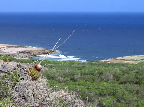
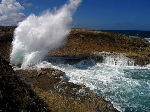
Largest: Christoffelpark · Shete Boka National Park
Currency · 26 October 2026
Netherlands Antillean guilder exchange rates today
Curacao uses the Netherlands Antillean guilder (ANG, ƒ). One US dollar buys 1.7995 ANG; over the last 30 days the ANG has lost 0.0% against the dollar.
What other currencies cost in ANG
Currency converter
Daily reference rates from the open-source currency-api (CC0), 26 Oct 2026. Banks and exchange offices add a margin.
World rankings
Where Curacao ranks
How Curacao compares with the rest of the world — open any card for the full ranking.
Airports
Airports in Curacao
1 airports and airfields — 1 large, 0 medium and 0 small, plus 0 heliports. 1 have scheduled passenger flights.
Borders
No land borders
Curacao has no land borders with other countries. Coastline: 364 km.
People
Population & society
Religion
Largest cities: Willemstad (144,000)
Economy
Economy
Main industries
tourism, petroleum refining, petroleum transshipment, light manufacturing, financial and business services
Export partners
Armenia 57%, USA 15%, Guyana 5%, Dominican Republic 4%, Netherlands 2% (2023)
Top exports
diamonds, refined petroleum, crude petroleum, gold, petroleum coke (2023)
Frequently asked questions about Curacao
What do I need to travel to Curacao?
Where is Curacao?
What is Curacao known for?
What is the capital of Curacao?
What language is spoken in Curacao?
What currency does Curacao use?
What is the calling code of Curacao?
Does Curacao have land borders?
What is the speed limit in Curacao?
Is Curacao safe to visit?
When is the best time to visit Curacao?
What plug type does Curacao use?
How many airports does Curacao have?
Sources: CIA World Factbook (public domain); World Bank Open Data (CC BY 4.0); names, languages and currencies: mledoze/countries (ODbL); flag: flag-icons (MIT); coat of arms: Wikimedia Commons (file page); exchange rates: Daily reference rates from the open-source currency-api (CC0); airports: OurAirports.