
Northern Europe · Territory

Faroe Islands: Travel Guide & Requirements
· Færøerne · Føroyar
The Faroe Islands is a territory in Northern Europe with its capital in Torshavn. It has a population of 54,900 (#201 in the world) and covers 1,393 km². The official languages are Danish and Faroese. The currency is the Faroese króna (FOK, kr).
Where is the Faroe Islands? Map of the Faroe Islands
Northern Europe, island group between the Norwegian Sea and the North Atlantic Ocean, about halfway between Iceland and Norway.
- Region
- Northern Europe
- Coordinates
- 62° N, 7° W
- Neighbours
- none (no land borders)
- Coastline
- 1,117 km
- Faroe Islands
- Capital
Before you go
8 things to know before you travel to the Faroe Islands
- Best time to go: January to December — when daytime highs in Torshavn are around 6–12°C.
- Money: the Faroese króna (FOK).
- Plugs: type C, E, F and K, 230 V, 50 Hz — standard 220–240 V: devices from the US or Japan (110–120 V) need a converter unless they are dual voltage (100–240 V).
- Emergency numbers: Police 112, Ambulance 112, Fire 112.
- Language: Danish and Faroese are official.
- Driving: on the right.
- Time zone: UTC0 in Torshavn.
- Capital: Torshavn. About 54,900 people live in the Faroe Islands.
Key facts
Faroe Islands at a glance
Languages spoken: Faroese 93.8% (derived from Old Norse), Danish 3.2%, other 3% (2011 est.)
Geography & history
About the Faroe Islands
The Faroe Islands were already populated by about A.D. 500, but whether the original settlers were Celtic or early Norse (or someone else) has yet to be determined. Viking settlers arrived on the islands in the 9th century, and the islands served as an important stepping stone for medieval Viking exploration of the North Atlantic. The islands have been connected politically to Denmark since the 14th century, and today the Faroe Islands are a self-governing dependency of Denmark. The Home Rule Act of 1948 granted a high degree of self-government to the Faroese, who have autonomy over most internal affairs and external trade, while Denmark is responsible for justice, defense, and some foreign…
Read the full history
The Faroe Islands were already populated by about A.D. 500, but whether the original settlers were Celtic or early Norse (or someone else) has yet to be determined. Viking settlers arrived on the islands in the 9th century, and the islands served as an important stepping stone for medieval Viking exploration of the North Atlantic. The islands have been connected politically to Denmark since the 14th century, and today the Faroe Islands are a self-governing dependency of Denmark. The Home Rule Act of 1948 granted a high degree of self-government to the Faroese, who have autonomy over most internal affairs and external trade, while Denmark is responsible for justice, defense, and some foreign affairs. The Faroe Islands are not part of the European Union.
Location
Northern Europe, island group between the Norwegian Sea and the North Atlantic Ocean, about halfway between Iceland and Norway
Climate
mild winters, cool summers; usually overcast; foggy, windy
Terrain
rugged, rocky, some low peaks; cliffs along most of coast
Highest point
Slaettaratindur 882 m
Natural resources
fish, whales, hydropower, possible oil and gas
Natural hazards
strong winds and heavy rains can occur throughout the year
National symbols
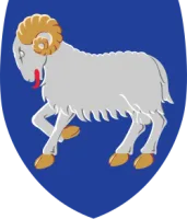
ram
Weather
Best time to visit the Faroe Islands
The best time to visit the Faroe Islands is January to December, when daytime highs in Torshavn are around 6–12°C. August is the warmest month (12°C by day), February the coldest (4°C at night), and December the wettest with about 130 mm of rain.
- Jan6°C4°C
- Feb6°C4°C
- Mar6°C4°C
- Apr7°C5°C
- May8°C6°C
- Jun10°C9°C
- Jul12°C10°C
- Aug12°C10°C
- Sep11°C10°C
- Oct9°C8°C
- Nov8°C6°C
- Dec7°C5°C
Best time Good Less ideal
Before you go
Plugs, voltage & emergency numbers in the Faroe Islands
Plugs & sockets
- Type C (Europlug)two round pins
- Type Etwo round pins and a hole for the socket's earth pin
- Type F (Schuko)two round pins with earth clips on the sides
- Type Ktwo round pins and a half-round earth pin
230 V, 50 Hz · Standard 220–240 V: devices from the US or Japan (110–120 V) need a converter unless they are dual voltage (100–240 V).
Emergency numbers
112 works from any mobile phone, even without a SIM card in most networks. All countries →
Sources: Wikipedia — Mains electricity by country and List of emergency telephone numbers (CC BY-SA 4.0).
World rankings
Where the Faroe Islands ranks
How the Faroe Islands compares with the rest of the world — open any card for the full ranking.
Airports
Airports in the Faroe Islands
13 airports and airfields — 1 large, 0 medium and 0 small, plus 12 heliports. 11 have scheduled passenger flights.
Borders
No land borders
The Faroe Islands has no land borders with other countries. Coastline: 1,117 km.
People
Population & society
Religion
Largest cities: Torshavn (21,000)
Economy
Economy
Main industries
fishing, fish processing, tourism, small ship repair and refurbishment, handicrafts
Export partners
Russia 26.4%, UK 14.1%, Germany 8.4%, China 7.9%, Spain 6.8%, Denmark 6.2%, US 4.7%, Poland 4.4%, Norway 4.1% (2017)
Top exports
fish and fish products (2021)
Travel tools
Handy before every trip to the Faroe Islands
Frequently asked questions about the Faroe Islands
Where is the Faroe Islands?
What is the capital of the Faroe Islands?
What language is spoken in the Faroe Islands?
What currency does the Faroe Islands use?
What is the calling code of the Faroe Islands?
Does the Faroe Islands have land borders?
When is the best time to visit the Faroe Islands?
What plug type does the Faroe Islands use?
How many airports does the Faroe Islands have?
Sources: CIA World Factbook (public domain); World Bank Open Data (CC BY 4.0); names, languages and currencies: mledoze/countries (ODbL); flag: flag-icons (MIT); coat of arms: Wikimedia Commons (file page); exchange rates: Daily reference rates from the open-source currency-api (CC0); airports: OurAirports.