
Micronesia · Territory

Guam: Travel Guide & Requirements
· Guåhån
Guam is a territory in Micronesia with its capital in Hagatna. It has a population of 168,999 (#184 in the world) and covers 544 km². The official languages are Chamorro, English and Spanish. The currency is the United States dollar (USD, $).
Where is Guam? Map of Guam
Oceania, island in the North Pacific Ocean, about three-quarters of the way from Hawaii to the Philippines.
- Region
- Micronesia
- Coordinates
- 13.4667° N, 144.7833° E
- Neighbours
- none (no land borders)
- Coastline
- 126 km
- Guam
- Capital
Before you go
8 things to know before you travel to Guam
- Best time to go: December to May — when daytime highs in Hagatna are around 28–29°C.
- Money: the United States dollar (USD) — 1 euro is about 1.1222 USD.
- Plugs: type A and B, 110 V, 60 Hz — low-voltage country: devices made only for 220–240 V need a voltage converter. Phone and laptop chargers (100–240 V) only need a plug adapter.
- Emergency numbers: Police 911, Ambulance 911, Fire 911.
- Language: Chamorro, English and Spanish are official.
- Driving: on the right — speed limits are 45 mph outside built-up areas.
- Time zone: UTC+10 in Hagatna.
- Capital: Hagatna. About 168,999 people live in Guam.
Key facts
Guam at a glance
Languages spoken: English 43.3%, Filipino 24.9%, Chamorro 16%, other Pacific Island languages 9.4%, Asian languages 6.5% (2020 est.)
Geography & history
About Guam
Guam was settled by Austronesian people around 1500 B.C. These people became the indigenous Chamorro and were influenced by later migrations, including the Micronesians in the first millennium A.D., and island Southeast Asians around 900. Society was stratified, with higher classes living along the coast and lower classes living inland. Spanish explorer Ferdinand MAGELLAN was the first European to see Guam in 1521, and Spain claimed the island in 1565 because it served as a refueling stop for ships between Mexico and the Philippines. Spain formally colonized Guam in 1668. Spain’s brutal repression of the Chamorro, along with new diseases and intermittent warfare, reduced the indigenous popu…
Read the full history
Guam was settled by Austronesian people around 1500 B.C. These people became the indigenous Chamorro and were influenced by later migrations, including the Micronesians in the first millennium A.D., and island Southeast Asians around 900. Society was stratified, with higher classes living along the coast and lower classes living inland. Spanish explorer Ferdinand MAGELLAN was the first European to see Guam in 1521, and Spain claimed the island in 1565 because it served as a refueling stop for ships between Mexico and the Philippines. Spain formally colonized Guam in 1668. Spain’s brutal repression of the Chamorro, along with new diseases and intermittent warfare, reduced the indigenous population from more than 100,000 to less than 5,000 by the 1700s. Spain tried to repopulate the island by forcing people from nearby islands to settle on Guam and preventing them from escaping. Guam became a hub for whalers and traders in the western Pacific in the early 1800s. During the 1898 Spanish-American War, the US Navy occupied Guam and set up a military administration. The US Navy opposed local control of government despite repeated petitions from the Chamorro. Japan invaded Guam in 1941 and instituted a repressive regime. During the US recapture of Guam in 1944, the island’s two largest villages were destroyed. After World War II, political pressure from local Chamorro leaders led to Guam being established as an unincorporated organized US territory in 1950, with US citizenship granted to all Chamorro. In a referendum in 1982, more than 75% of voters chose closer relations with the US over independence, although no change in status was made because of disagreements on the future right of Chamorro self-determination. The US military holds about 29% of Guam’s land and stations several thousand troops on the island. The installations are some of the most strategically important US bases in the Pacific; they also constitute the island’s most important source of income and economic stability.
Location
Oceania, island in the North Pacific Ocean, about three-quarters of the way from Hawaii to the Philippines
Climate
tropical marine; generally warm and humid, moderated by northeast trade winds; dry season (January to June), rainy season (July to December); little seasonal temperature variation
Terrain
volcanic origin, surrounded by coral reefs; relatively flat coralline limestone plateau (source of most fresh water), with steep coastal cliffs and narrow coastal plains in north, low hills in center, mountains in south
Highest point
Mount Lamlam 406 m
Natural resources
aquatic wildlife (supporting tourism), fishing (largely undeveloped)
Natural hazards
frequent squalls during rainy season; relatively rare but potentially destructive typhoons (June to December)
National symbols
coconut tree
Driving
Speed limits & road rules in Guam
The default speed limits in Guam are 45 mph outside built-up areas. Posted signs always take priority over these defaults.
- SPEED
LIMIT4545 mphOutside built-up areasCountry roads
- International Driving PermitNot a party to the IDP conventionsCheck with the embassy whether your licence is accepted
- Driving sideDrive on the rightOvertake on the left
Speed limits: OpenStreetMap wiki — Default speed limits (CC BY-SA 2.0). Road-safety laws: WHO Global Health Observatory. Compare speed limits and alcohol limits by country. Defaults for cars; local signs, weather and vehicle type can lower them.
Weather
Best time to visit Guam
The best time to visit Guam is December to May, when daytime highs in Hagatna are around 28–29°C. June and November are also a good time to go. June is the warmest month (29°C by day), February the coldest (27°C at night), and August the wettest with about 315 mm of rain.
- Jan28°C27°C
- Feb28°C27°C
- Mar28°C27°C
- Apr28°C27°C
- May29°C28°C
- Jun29°C28°C
- Jul29°C28°C
- Aug29°C28°C
- Sep29°C28°C
- Oct29°C28°C
- Nov29°C28°C
- Dec29°C28°C
Best time Good Less ideal
Before you go
Plugs, voltage & emergency numbers in Guam
Plugs & sockets
110 V, 60 Hz · Low-voltage country: devices made only for 220–240 V need a voltage converter. Phone and laptop chargers (100–240 V) only need a plug adapter.
Emergency numbers
Save the local numbers before you travel — 112 or 911 may not connect here. All countries →
Sources: Wikipedia — Mains electricity by country and List of emergency telephone numbers (CC BY-SA 4.0).
Currency · 26 October 2026
United States dollar exchange rates today
Guam uses the United States dollar (USD, $).
What other currencies cost in USD
Currency converter
Daily reference rates from the open-source currency-api (CC0), 26 Oct 2026. Banks and exchange offices add a margin.
World rankings
Where Guam ranks
How Guam compares with the rest of the world — open any card for the full ranking.
Airports
Airports in Guam
5 airports and airfields — 1 large, 1 medium and 1 small, plus 2 heliports. 1 have scheduled passenger flights.
Borders
No land borders
Guam has no land borders with other countries. Coastline: 126 km.
People
Population & society
Religion
Largest cities: Hagatna (147,000)
Economy
Economy
Main industries
national defense, tourism, construction, transshipment services, concrete products, printing and publishing, food processing, textiles
Export partners
Taiwan 42%, Hong Kong 12%, Philippines 11%, Italy 8%, Australia 6% (2023)
Top exports
scrap iron, scrap copper, trunks and cases (2023)
Travel tools
Handy before every trip to Guam
News
Latest travel news about Guam
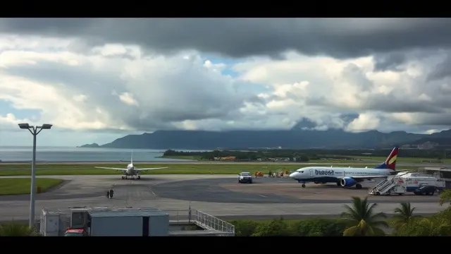
United Airlines Issues Travel Advisory for Pacific Airports Amid Storm Threat
United Airlines has announced a travel advisory affecting seven Pacific airports due to Tropical Storm Champi, offering flexibility for rebooking fli…

United Airlines Introduces Starlink Wi-Fi on Guam-Based 737 MAX 8s
United Airlines has begun equipping its Boeing 737 MAX 8 aircraft based in Guam with complimentary Starlink Wi-Fi, enhancing connectivity for flights…
Frequently asked questions about Guam
Where is Guam?
What is the capital of Guam?
What language is spoken in Guam?
What currency does Guam use?
What is the calling code of Guam?
Does Guam have land borders?
What is the speed limit in Guam?
When is the best time to visit Guam?
What plug type does Guam use?
How many airports does Guam have?
Sources: CIA World Factbook (public domain); World Bank Open Data (CC BY 4.0); names, languages and currencies: mledoze/countries (ODbL); flag: flag-icons (MIT); coat of arms: Wikimedia Commons (file page); exchange rates: Daily reference rates from the open-source currency-api (CC0); airports: OurAirports.