
Micronesia · Territory

Northern Mariana Islands: Travel Guide & Requirements
Commonwealth of the Northern Mariana Islands · Sankattan Siha Na Islas Mariånas
The Northern Mariana Islands is a territory in Micronesia with its capital in Saipan. It has a population of 43,541 (#206 in the world) and covers 464 km². The official languages are Carolinian, Chamorro and English. The currency is the United States dollar (USD, $).
Where is the Northern Mariana Islands? Map of the Northern Mariana Islands
Oceania, islands in the North Pacific Ocean, about three-quarters of the way from Hawaii to the Philippines.
- Region
- Micronesia
- Coordinates
- 15.2° N, 145.75° E
- Neighbours
- none (no land borders)
- Coastline
- 1,482 km
- Northern Mariana Islands
- Capital
Before you go
7 things to know before you travel to the Northern Mariana Islands
- Best time to go: December to May — when daytime highs in Saipan are around 27–29°C.
- Money: the United States dollar (USD) — 1 euro is about 1.1222 USD.
- Emergency numbers: Police 911, Ambulance 911, Fire 911.
- Language: Carolinian, Chamorro and English are official.
- Driving: on the right.
- Time zone: UTC+10 in Saipan.
- Capital: Saipan. About 43,541 people live in the Northern Mariana Islands.
Key facts
Northern Mariana Islands at a glance
Languages spoken: Philippine languages 32.8%, Chamorro (official) 24.1%, English (official) 17%, other Pacific island languages 10.1% (includes Carolinian (official), Chinese 6.8%, other Asian languages 7.3%, other 1.9% (2010 est.)
Geography & history
About the Northern Mariana Islands
Austronesian people settled the Northern Mariana Islands around 1500 B.C. These people became the indigenous Chamorro and were influenced by later migrations, including Micronesians in the first century A.D. and island Southeast Asians around 900. Spanish explorer Ferdinand MAGELLAN sailed through the Mariana Islands in 1521, and Spain claimed them in 1565. Spain formally colonized the Mariana Islands in 1668 and administered the archipelago from Guam. Spain’s brutal repression of the Chamorro, along with new diseases and intermittent warfare, reduced the indigenous population by about 90% in the 1700s. With a similar dynamic occurring on Guam, Spain forced the Chamorro from the Northern Ma…
Read the full history
Austronesian people settled the Northern Mariana Islands around 1500 B.C. These people became the indigenous Chamorro and were influenced by later migrations, including Micronesians in the first century A.D. and island Southeast Asians around 900. Spanish explorer Ferdinand MAGELLAN sailed through the Mariana Islands in 1521, and Spain claimed them in 1565. Spain formally colonized the Mariana Islands in 1668 and administered the archipelago from Guam. Spain’s brutal repression of the Chamorro, along with new diseases and intermittent warfare, reduced the indigenous population by about 90% in the 1700s. With a similar dynamic occurring on Guam, Spain forced the Chamorro from the Northern Mariana Islands to resettle there. By the time they returned, many other Micronesians, including Chuukese and Yapese, had already settled on their islands. In 1898, Spain ceded Guam to the US after the Spanish-American War but sold the Northern Mariana Islands to Germany under the German-Spanish Treaty of 1899. Germany administered the territory from German New Guinea but took a hands-off approach to day-to-day life. Following World War I, Japan administered the islands under a League of Nations mandate. Japan focused on sugar production and brought in thousands of Japanese laborers, who quickly outnumbered the Chamorro on the islands. During World War II, Japan invaded Guam from the Northern Mariana Islands and used Marianan Chamorro as translators with Guamanian Chamorro, creating friction between the two Chamorro communities that continues to this day. The US captured the Northern Mariana Islands in 1944 after the Battle of Saipan and later administered them as part of the Trust Territory of the Pacific Islands (TTPI). On four occasions in the 1950s and 1960s, voters opted for integration with Guam, which Guam rejected in 1969. In 1978, the Northern Mariana Islands was granted self-governance separate from the rest of the TTPI, and in 1986, islanders were granted US citizenship, with the territory coming under US sovereignty as the Commonwealth of the Northern Mariana Islands (CNMI). In 2009, the CNMI became the final US territory to elect a nonvoting delegate to the US Congress.
Location
Oceania, islands in the North Pacific Ocean, about three-quarters of the way from Hawaii to the Philippines
Climate
tropical marine; moderated by northeast trade winds, little seasonal temperature variation; dry season December to June, rainy season July to October
Terrain
the southern islands in this north-south trending archipelago are limestone, with fringing coral reefs; the northern islands are volcanic, with active volcanoes on several islands
Highest point
Agrihan Volcano 965 m
Natural resources
arable land, fish
Natural hazards
active volcanoes on Pagan and Agrihan; typhoons (especially August to November)
National symbols
latte stone
Weather
Best time to visit the Northern Mariana Islands
The best time to visit the Northern Mariana Islands is December to May, when daytime highs in Saipan are around 27–29°C. June and November are also a good time to go. June is the warmest month (29°C by day), February the coldest (27°C at night), and August the wettest with about 302 mm of rain.
- Jan28°C27°C
- Feb27°C27°C
- Mar28°C27°C
- Apr28°C27°C
- May29°C28°C
- Jun29°C28°C
- Jul29°C28°C
- Aug29°C28°C
- Sep29°C28°C
- Oct29°C28°C
- Nov29°C28°C
- Dec28°C28°C
Best time Good Less ideal
Before you go
Plugs, voltage & emergency numbers in the Northern Mariana Islands
Emergency numbers
Save the local numbers before you travel — 112 or 911 may not connect here. All countries →
Sources: Wikipedia — Mains electricity by country and List of emergency telephone numbers (CC BY-SA 4.0).
Currency · 26 October 2026
United States dollar exchange rates today
The Northern Mariana Islands uses the United States dollar (USD, $).
What other currencies cost in USD
Currency converter
Daily reference rates from the open-source currency-api (CC0), 26 Oct 2026. Banks and exchange offices add a margin.
World rankings
Where the Northern Mariana Islands ranks
How the Northern Mariana Islands compares with the rest of the world — open any card for the full ranking.
Airports
Airports in the Northern Mariana Islands
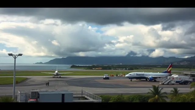
6 airports and airfields — 1 large, 2 medium and 1 small, plus 2 heliports. 3 have scheduled passenger flights.
Borders
No land borders
The Northern Mariana Islands has no land borders with other countries. Coastline: 1,482 km.
People
Population & society
Largest cities: Saipan (51,000)
Economy
Economy
Main industries
tourism, banking, construction, fishing, handicrafts, other services
Export partners
Sweden 21%, Singapore 20%, Hong Kong 12%, UK 8%, India 7% (2023)
Top exports
scrap iron, refined petroleum, scrap copper, hydraulic engines, integrated circuits (2021)
Travel tools
Handy before every trip to the Northern Mariana Islands
News
Latest travel news about the Northern Mariana Islands
Frequently asked questions about the Northern Mariana Islands
Where is the Northern Mariana Islands?
What is the capital of the Northern Mariana Islands?
What language is spoken in the Northern Mariana Islands?
What currency does the Northern Mariana Islands use?
What is the calling code of the Northern Mariana Islands?
Does the Northern Mariana Islands have land borders?
When is the best time to visit the Northern Mariana Islands?
How many airports does the Northern Mariana Islands have?
Sources: CIA World Factbook (public domain); World Bank Open Data (CC BY 4.0); names, languages and currencies: mledoze/countries (ODbL); flag: flag-icons (MIT); coat of arms: Wikimedia Commons (file page); exchange rates: Daily reference rates from the open-source currency-api (CC0); airports: OurAirports.