
 Venezuela · national park
Aguaro-Guariquito National Park
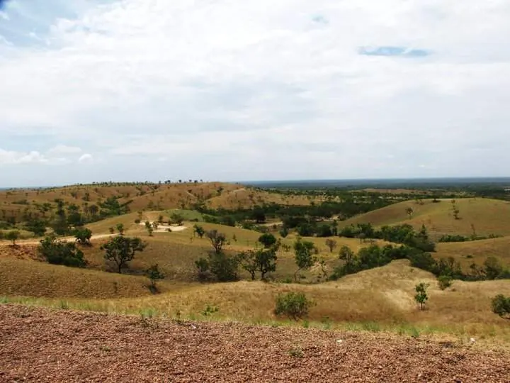
Aguaro-Guariquito National Park is a national park in Venezuela, established in 1974, covering 5,857 km² (2,261 sq mi). It is the #4 largest of Venezuela's 42 national parks. National historical monument of Venezuela in Las Mercedes.
- Area
- 5,857 km²
- Established
- 1974
- IUCN
- II: National Park
- Nearest airport
- VLN · 243 km
Nearest airports to Aguaro-Guariquito National Park
- 1 VLN243 kmstraight line
- 2 PCR249 kmstraight line
- 3Maiquetía Simón Bolívar International AirportCCS257 kmstraight lineMaiquetía, Venezuela
Airports in VenezuelaTransfers & Meet & Greet →
 Puerto Carreño, Colombia
More about Aguaro-Guariquito National Park
Aguaro-Guariquito National Park is one of 42 national parks in Venezuela — national historical monument of Venezuela in Las Mercedes. It covers 5,857 km² (585,700 ha) — about 3.7 times the size of London, making it the #4 largest national park in Venezuela (4.6% of the country's national park area).
History and protection
The park was established in 1974, 52 years ago — the first national parks in Venezuela date back to 1937. It is listed in IUCN category II: National Park — protecting whole ecosystems while welcoming visitors for recreation and education.
Visiting Aguaro-Guariquito National Park
The closest airport is Arturo Michelena International Airport (VLN), about 243 km away — around 5 h 16 min by car; alternatively German Olano Airport (PCR, 249 km). Other national parks within reach include Santos Luzardo National Park (5,844 km²), Guatopo National Park (1,225 km²), Laguna de Tacarigua National Park (391 km²) and Macarao National Park (150 km²) — easy to combine on one trip.
Frequently asked questions
How big is Aguaro-Guariquito National Park?
When was Aguaro-Guariquito National Park established?
What is the nearest airport to Aguaro-Guariquito National Park?
What protection category is Aguaro-Guariquito National Park?
Data: Wikidata (CC0), English Wikipedia and Wikimedia Commons.