
Caribbean · Territory

Aruba: Travel Guide & Requirements
Aruba is a territory in Caribbean with its capital in Oranjestad. It has a population of 108,785 (#190 in the world) and covers 180 km². The official languages are Dutch and Papiamento. The currency is the Aruban florin (AWG, ƒ).
Where is Aruba? Map of Aruba
Caribbean, island in the Caribbean Sea, north of Venezuela.
- Region
- Caribbean
- Coordinates
- 12.5° N, 69.9667° W
- Neighbours
- none (no land borders)
- Coastline
- 69 km
- Aruba
- Capital
Travel requirements
What you need to travel to Aruba
- Passport
A passport valid for your whole stay (check the rules of the governing country).
- Travel advice
Safe to visit — US and UK advice.
Before you go
10 things to know before you travel to Aruba
- Safety: Yes — Aruba is generally safe to visit: the US State Department rates Aruba Level 1 (“Exercise Normal Precautions”), and the UK Foreign Office has no warnings against travel there.
- Best time to go: January to May — when daytime highs in Oranjestad are around 27–28°C.
- Money: the Aruban florin (AWG) — 1 US dollar is about 1.7900 AWG.
- Plugs: type A, B and F, 127 V, 60 Hz — low-voltage country: devices made only for 220–240 V need a voltage converter. Phone and laptop chargers (100–240 V) only need a plug adapter.
- Emergency numbers: Police 911, Ambulance 911, Fire 911.
- Language: Dutch and Papiamento are official; English is also spoken.
- Driving: on the right — speed limits are 50 km/h in built-up areas and 80 km/h outside built-up areas.
- Time zone: UTC-4 in Oranjestad.
- Capital: Oranjestad. About 108,785 people live in Aruba.
- Outdoors: 1 national park.
Key facts
Aruba at a glance
Languages spoken: Papiamento (official) (a creole language that mixes Portuguese, Spanish, Dutch, English, French, African languages, and Arawak) 69.4%, Spanish 13.7%, English (widely spoken) 7.1%, Dutch (official) 6.1%, Chinese 1.5%, other 1.7%, unspecified 0.4% (2010 est.)
Geography & history
About Aruba
Discovered and claimed for Spain in 1499, Aruba was acquired by the Dutch in 1636. Three main industries have since dominated the island's economy: gold mining, oil refining, and tourism. A 19th-century gold rush was followed by prosperity brought on by the opening of an oil refinery in 1924. The last decades of the 20th century saw a boom in the tourism industry. Aruba seceded from the Netherlands Antilles in 1986 and became a separate, semi-autonomous member of the Kingdom of the Netherlands. Movement toward full independence was halted at Aruba's request in 1990.
Location
Caribbean, island in the Caribbean Sea, north of Venezuela
Climate
tropical marine; little seasonal temperature variation
Terrain
flat with a few hills; scant vegetation
Highest point
Ceru Jamanota 188 m
Natural resources
NEGL; white sandy beaches foster tourism
Natural hazards
hurricanes; lies outside the Caribbean hurricane belt and is rarely threatened
National symbols
Hooiberg (Haystack) Hill
Driving
Speed limits & road rules in Aruba
The default speed limits in Aruba are 50 km/h in built-up areas and 80 km/h outside built-up areas. Posted signs always take priority over these defaults.
- 5050 km/hBuilt-up areasTowns and cities
- 8080 km/hOutside built-up areasCountry roads
- International Driving PermitNot a party to the IDP conventionsCheck with the embassy whether your licence is accepted
- Driving sideDrive on the rightOvertake on the left
Speed limits: OpenStreetMap wiki — Default speed limits (CC BY-SA 2.0). Road-safety laws: WHO Global Health Observatory. Compare speed limits and alcohol limits by country. Defaults for cars; local signs, weather and vehicle type can lower them.
Safety
Is Aruba safe to visit?
Yes — Aruba is generally safe to visit: the US State Department rates Aruba Level 1 (“Exercise Normal Precautions”), and the UK Foreign Office has no warnings against travel there.
 US State Department
 UK Foreign Office (FCDO)
Latest update: This travel advice was reviewed for accuracy and there are no significant updates.
Updated 7 Jul 2026 · Full travel advice
Sources: US Department of State travel advisories (public domain) and UK FCDO foreign travel advice (contains public sector information licensed under the Open Government Licence v3.0). Checked daily. Advice can change quickly — always read the official page before you travel.
Weather
Best time to visit Aruba
The best time to visit Aruba is January to May, when daytime highs in Oranjestad are around 27–28°C. June to September and November to December are also a good time to go. September is the warmest month (29°C by day), February the coldest (26°C at night), and October the wettest with about 94 mm of rain.
- Jan27°C26°C
- Feb27°C26°C
- Mar27°C26°C
- Apr28°C26°C
- May28°C27°C
- Jun28°C27°C
- Jul28°C27°C
- Aug29°C28°C
- Sep29°C28°C
- Oct29°C28°C
- Nov29°C28°C
- Dec28°C27°C
Best time Good Less ideal
Before you go
Plugs, voltage & emergency numbers in Aruba
Plugs & sockets
- Type Atwo flat parallel pins
- Type Btwo flat parallel pins and a round earth pin
- Type F (Schuko)two round pins with earth clips on the sides
127 V, 60 Hz · Low-voltage country: devices made only for 220–240 V need a voltage converter. Phone and laptop chargers (100–240 V) only need a plug adapter.
Emergency numbers
Save the local numbers before you travel — 112 or 911 may not connect here. All countries →
Sources: Wikipedia — Mains electricity by country and List of emergency telephone numbers (CC BY-SA 4.0).
National parks
1 national park in Aruba
- oldest from 2000
Largest: Arikok National Park
Currency · 26 October 2026
Aruban florin exchange rates today
Aruba uses the Aruban florin (AWG, ƒ). One US dollar buys 1.7900 AWG; over the last 30 days the AWG has gained 0.0% against the dollar.
What other currencies cost in AWG
Currency converter
Daily reference rates from the open-source currency-api (CC0), 26 Oct 2026. Banks and exchange offices add a margin.
World rankings
Where Aruba ranks
How Aruba compares with the rest of the world — open any card for the full ranking.
Airports
Airports in Aruba
1 airports and airfields — 1 large, 0 medium and 0 small, plus 0 heliports. 1 have scheduled passenger flights.
Borders
No land borders
Aruba has no land borders with other countries. Coastline: 69 km.
People
Population & society
Religion
Largest cities: Oranjestad (30,000)
Economy
Economy
Main industries
tourism, petroleum transshipment facilities, banking
Export partners
Jordan 34%, Colombia 31%, USA 7%, Guyana 5%, Slovakia 5% (2023)
Top exports
tobacco, gas turbines, refined petroleum, steam turbines, heating machinery (2023)
News
Latest travel news about Aruba
Southwest to open 11 tropical nonstop routes from US airports from November
Southwest Airlines is adding 11 nonstop international routes from US airports, starting 1 November with Las Vegas to Puerto Vallarta. Two of the new …
Caribbean retirement permits and income rules island by island
A comparison of eight Caribbean retirement destinations sets out the permits and income thresholds facing foreign retirees, from the Dominican Republ…
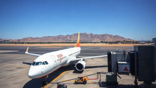
Southwest Adds 11 International Routes, Including Two to Liberia, Costa Rica
Southwest Airlines is launching 11 new international routes between November 2026 and June 2027, with nonstops to Liberia, Costa Rica from both Nashv…
Frequently asked questions about Aruba
What do I need to travel to Aruba?
Where is Aruba?
What is Aruba known for?
What is the capital of Aruba?
What language is spoken in Aruba?
What currency does Aruba use?
What is the calling code of Aruba?
Does Aruba have land borders?
What is the speed limit in Aruba?
Is Aruba safe to visit?
When is the best time to visit Aruba?
What plug type does Aruba use?
How many airports does Aruba have?
Sources: CIA World Factbook (public domain); World Bank Open Data (CC BY 4.0); names, languages and currencies: mledoze/countries (ODbL); flag: flag-icons (MIT); coat of arms: Wikimedia Commons (file page); exchange rates: Daily reference rates from the open-source currency-api (CC0); airports: OurAirports.